

Data Acquisition and Analytics
New builds, retrofits, and operations all benefit from accurate, connected data. For retrofits, LiDAR, GPR, and aerial scans capture exact conditions and terrain, feeding 3D/BIM models that cut clashes and speed installs. For new facilities, that same modeling forms the basis of a digital twin. In operation, SCADA and remote monitoring keep the twin current through dashboards and CMMS. The result is clear visibility, cleaner tie-ins, fewer surprises, and faster decisions across the life of the facility.

Terrestrial LiDAR
Astra employs advanced Terrestrial LiDAR technology to deliver high-precision data for a range of engineering and construction applications. Our LiDAR scanning services enable rapid data collection, detailed 3D mapping, and enhanced safety and accessibility, ensuring accurate and efficient project execution.

Aerial LiDAR
Capture every detail of your site with precision mapping technology, ensuring the most accurate designs from the very start to finish.
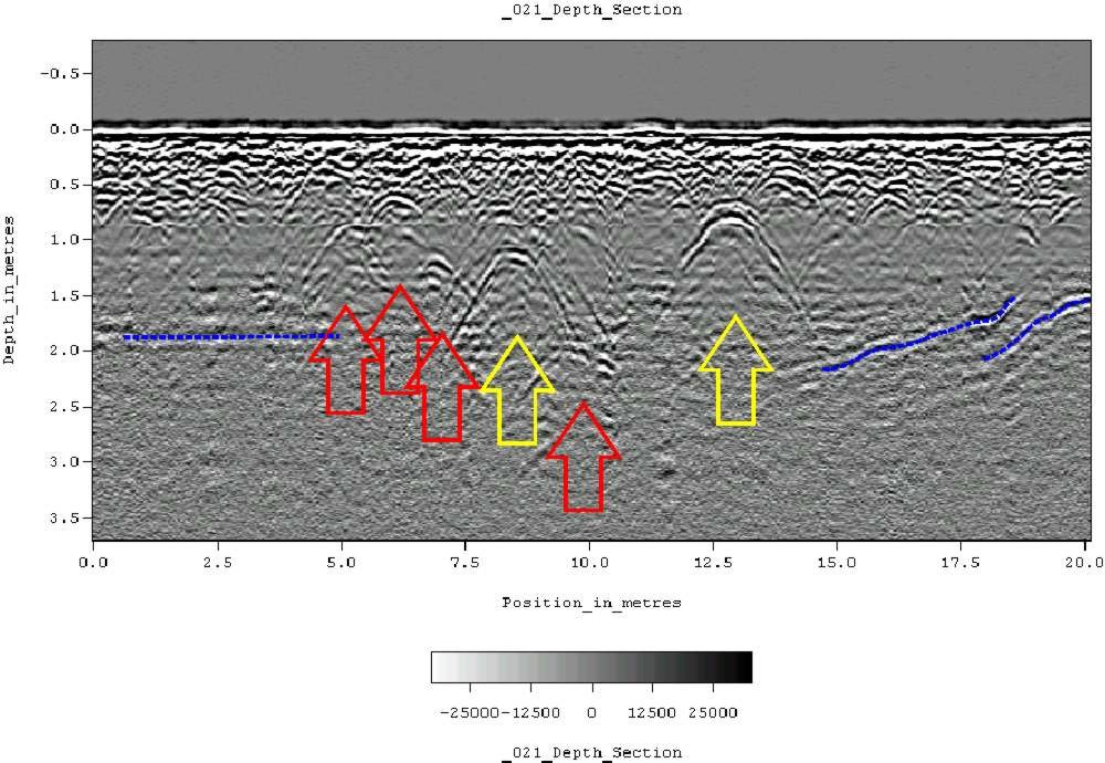
GPR
Ground Penetrating Radar (GPR) provides a non-invasive method for detecting underground utilities, structures, and anomalies, giving you precise data to avoid surprises and costly delays.

Subsurface Utility
Our Subsurface Utility Engineering (SUE) services provide essential underground utility data, ensuring safe and efficient project execution. Identify potential conflicts early and avoid costly delays with our expertise.
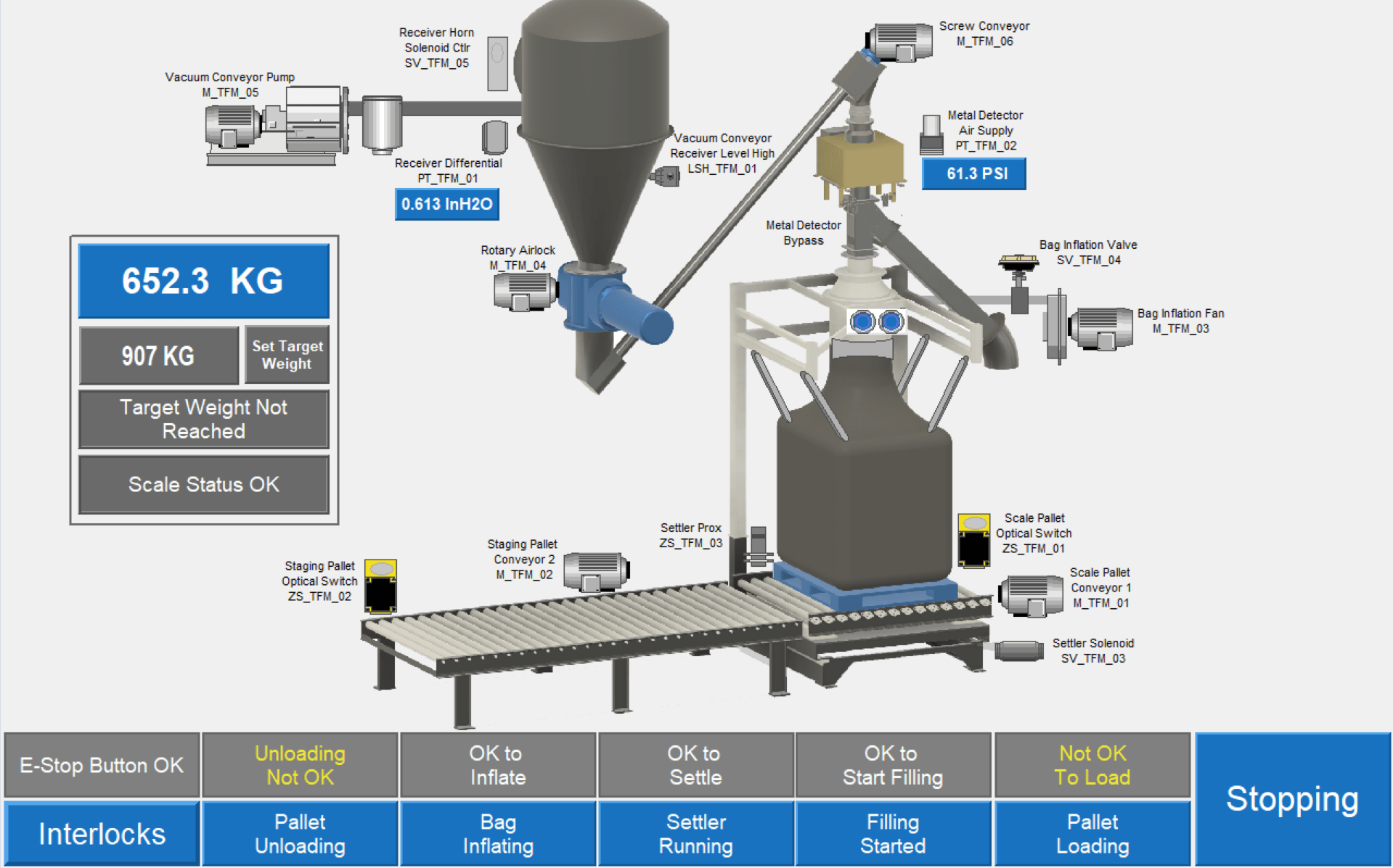
SCADA and Remote Monitoring
Monitor, control, and optimize your operations in real time. Our SCADA and remote monitoring systems provide secure, data-driven insights for smarter decision-making, anytime and anywhere. Gain greater visibility into your systems and respond faster to changing conditions.

Explore Our Other Services
-

Construction Engineering
-
Automation & Robotics
-

Process Engineering
-

Engineering Services